We have new forums at NiteshKothari.com
TopBottom

Hughes HX280 Satellite Router Achieves Advanced Cryptographic Security Certification

Posted by world Jr at Thursday, March 10, 2011

Product Certified to FIPS 140-2 Security Level 2 for Military and Government Use

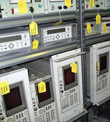
GERMANTOWN, Md., March 11, 2011 /PRNewswire/ -- Hughes Network Systems, LLC (HUGHES), the global leader in broadband satellite technologies and services, and a leading provider of managed network services, today announced its high-performance commercial satellite router, the HX280, has achieved Federal Information Processing Standards (FIPS) 140-2 Security Level 2 certification (certificate #1491), which is a cryptographic hardware and software accreditation given by the National Institute of Standards and Technology (NIST). Achieving Security Level 2 validates the HX280's sophisticated physical security mechanisms, including tamper-evident coating of the cryptographic keys and critical security parameters (CSPs), as well as other critical safeguards.

(Logo: http://photos.prnewswire.com/prnh/20110112/NE29456LOGO )

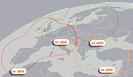
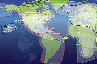
The Hughes HX280 is optimized for communications-on-the-move (COTM), which includes but is not limited to military operations and deployed environments. It maintains low-jitter secure voice, video and data IP-broadband communications, and can be configured in star and mesh topologies for simultaneous operations. As part of the commercially successful HX System from Hughes, the HX280 has global coverage that is ideal for military or government customers in theater.

"We are pleased to be able to offer our HX customers validated FIPS 140-2 Security Level 2, which means an even higher level of enhanced security for military and government networks," said Daniel Losada, senior director of the Defense and Intelligence Systems Division at Hughes. "It further extends the many applications of the versatile HX280, enabling secure communications-on-the-move anywhere in the world, including current conflict zones. And it comes integrated with our HX ExpertNMS™, the most advanced network management system available, providing powerful network diagnostic tools via an intuitive, user-friendly interface."

The HX280 can be deployed on land, at sea or in the air for comprehensive and highly secure net-centric communications. Fully compliant with IPoS/DVB-S2, including Adaptive Coding and Modulation (ACM), the world's most successful satellite air interface standard approved by TIA, ETSI and ITU, the HX280 employs frequency division multiple access (FDMA)/time division multiple access (TDMA) channels supporting data rates of up to 121Mbps outbound and up to 9.6 Mbps inbound. Optional Enhanced Signaling Security which meets TRANSEC standards is also available on the HX280.

For more information on FIPS 140-2 Security Level 2, or to view the HX280's validation certificate, visit http://ow.ly/4b647.

About Hughes Network Systems

Hughes Network Systems, LLC (Hughes) is the world's leading provider of satellite broadband for home and office, delivering innovative network technologies, managed services, and solutions for enterprises and governments globally. HughesNet® is the #1 high-speed satellite Internet service in the marketplace, with offerings to suit every budget. To date, Hughes has shipped more than 2.5 million systems to customers in over 100 countries, representing over 50 percent market share. Its products employ global standards approved by TIA, ETSI, and ITU organizations, including IPoS/DVB-S2, RSM-A, and GMR-1.

Headquartered outside Washington, D.C., in Germantown, Maryland, USA, Hughes Network Systems, LLC (Hughes) operates sales and support offices worldwide, and is a wholly owned subsidiary of Hughes Communications, Inc. (Nasdaq: HUGH). For more information, please visit www.hughes.com.

©2011 Hughes Network Systems, LLC. Hughes, HughesNet, and HX ExpertNMS are trademarks of Hughes Network Systems, LLC.

SOURCE Hughes Network Systems, LLC

Latest News


Aircell... Airing Out The Technologies

Posted by world Jr at

March 10, 2011 - Multiple technology platforms address a variety of in-air communications needs.

Aircell has unveiled an expanded technology roadmap for the delivery of its revolutionary and widely deployed Gogo® Inflight Internet service. In addition to Aircell’s existing and highly successful Air-to-Ground (ATG) technology, the company will enable connectivity via a next generation version of ATG (“ATG-4”) as well as Ka-band satellite technology. These technology options will be selectable at the aircraft or fleet level and enable attractive solutions for every airline, aircraft and mission.


* Ka-band satellite: Aircell’s Ka-band satellite technology will provide additional capacity to supplement what is available through ATG, ATG-4 and current generation satellite technology, as well as enable Gogo service beyond the continental United States (CONUS). Based on satellite launch and antenna development schedules, Aircell expects its Ka-band technology to be available for CONUS in 2013 and globally by 2015. Aircell expects many aircraft to take advantage of its unique and proprietary ability to integrate air-to-ground solutions with satellite solutions for better performance, enhanced features and higher reliability
* Air-to-Ground (ATG): With a proven track record of performance, reliability and scalability, Aircell’s ATG-based service will continue to provide a rich user experience for connected travelers by featuring 3G wireless utilizing EV-DO Rev. A
* ATG-4: Aircell’s ATG-4 service will significantly enhance the existing ATG network and improve per aircraft capacity by approximately four times current performance through the addition of Directional Antenna, Dual Modem and EV-DO Rev. B technologies. ATG-4 is scheduled for commercial delivery beginning in the first half of 2012. This new platform is backwards compatible and allows for upgrades to existing ATG systems through low cost retrofits

By offering multiple technology platforms, Aircell is the only provider able to meet the needs of any aircraft and its mission. ATG’s combination of low cost, small equipment footprint and high performance will continue to delight travelers in the future. At the same time, many larger aircraft with higher capacity needs will benefit from the improvements enabled by ATG-4, again at a low cost and with a smaller equipment footprint as compared to satellite solutions. Aircraft with missions beyond CONUS will benefit from the geographic flexibility a satellite solution provides. In advance of the global availability of Ka-based satellite service, Aircell can provide a Ku-based satellite solution for the international needs of its airline partners. For commercial airlines, Aircell’s technology roadmap will allow airlines to select the technology that best suits particular aircraft at a particular time, and to easily upgrade from one Aircell platform to another. In addition, all Aircell network technologies will utilize its enormous advantage in proprietary “know how” (including over 30 US and international patents for its inflight connectivity solutions), and will leverage its world-class systems for technical monitoring and support, customer care and billing. In the business aviation market, Aircell currently offers three different inflight technologies, including Iridium Satellite, Inmarsat SwiftBroadband (satellite) and Gogo Biz™ (ATG). Specific details about ATG-4 and Ka-band satellite technologies for the business aviation market will be released in the coming months.
source: www.satnews.com

Latest News


EU issues urgent call to 21 states on satellite network

Posted by world Jr at

BRUSSELS — The European Commission on Thursday ordered 21 EU states to get their act together and meet a deadline to install a pan-European mobile satellite network under its broadband-for-all drive.

Commission vice-president Neelie Kroes, a veteran of countless battles with telecoms providers over high roaming charges within the European Union single market, issued "an urgent call" to the 21 to "remove remaining legal uncertainties," a statement said.

The countries targeted are Belgium, Britain, Bulgaria, Cyprus, the Czech Republic, France, Germany, Greece, Hungary, Ireland, Italy, Latvia, Lithuania, Luxembourg, Malta, the Netherlands, Poland, Portugal, Slovakia, Slovenia and Spain.

Legal obstacles preventing two companies already selected by Brussels to develop the EU system centre on licence fees, the statement said.

The EU agreed in 2008 that pan-EU deployment of mobile satellite services should be in place by May 2011 at the latest for high-speed Internet, mobile television and radio or emergency communications to EU consumers and businesses.

The satellite network is also seen as key to ensuring innovative communications services reach rural and remote areas.
source: www.google.com

Latest News


Astra offers satellite internet without dish

Posted by world Jr at

Satellite operator SES Astra will offer households without broadband access from now on a possibility to gain high-speed internet via satellite without the need to install a satellite dish.

The data traffic is sent to the houses using the telephone line with computers being hooked up through a standard ADSL modem.

To be able to use the service, a central satellite dish for broadband service Astra2Connect has to be installed at the street cabinet of the local community. From there the signals are delivered to the households using the existing last-mile telephone infrastructure.

The solution, which can be implemented by telecommunications companies and internet service providers throughout Europe, enables a data rate of up to 6 Mbit/s. In German federal state Baden-Württemberg the technology is deployed for the first time in conjunction with the Ministry of Rural Affairs, Nutrition and Consumer Protection and supported by technology partners Nokia Siemens Networks and ND SatCom.

"Satellite is an ideal technology to offer rural areas without access to terrestrial broadband networks fast and reliable internet connections," said Michael Reiss, Division Vice President at the Ministry of Rural Affairs, Nutrition and Consumer Protection in Baden-Württemberg. "With SES Astra's new technology, communities in the white spots benefit from low costs in the set-up of the infrastructure which can be fully subsidised by a variety of funds available in Germany."
source: www.rapidtvnews.com

Latest News


Satellite Internet plan could threaten GPS

Posted by world Jr at

Small, inexpensive GPS jammers carried by truckers have caused the occasional shutdown of the Laas test installation at Newark Airport. The devices, powered by simply plugging into the cigarette lighter, are intended to foil interrogations of the truck's remotely installed GPS and its coupled cellphone by the trucking company's dispatcher to check on the vehicleπs location and progress.

No one has a firm estimate of the number of truck drivers who carry GPS jammers in their back pockets as they roll down the interstates: estimates vary from "a few thousand" to "tens of thousands." However, their jamming periods are usually fairly short and infrequent, and regular unscheduled stops in the same area could soon attract a dispatcher's attention. On the other hand, since there are not too many likely stopping places of interest on the New Jersey Turnpike abeam of EWR, it seems probable that some drivers are forgetting to unplug their jammers after their last unscheduled stops.

Nevertheless, the truckers' combined efforts could never even come close to matching the GPS-jamming potential of the 40,000 much higher powered ground transmitters that would form the mainstays of a nationwide satellite voice and Internet data service proposed by LightSquared, a company formed last year.

Coast-to-coast Network

Using LightSquared data in preliminary laboratory tests, Garmin experts demonstrated that such stations would start to interfere with a standard production TSO'd and LPV-capable GPS airborne receiver at a range of 13.8 miles and would totally jam it at 5.6 miles. In Garminπs words, should the FCC approve LightSquared's proposal, the transmitter network would cause "widespread severe GPS jamming," and would "deny GPS service over vast areas of the United States." Unstated by Garmin would be the parallel impact on ADS-B, as well as the loss of vital GPS timing within the nationπs critical government and commercial infrastructure.

How can this be allowed? Essentially, it is because LightSquared will operate in the L-Band radio frequency group from 1525 to 1559 MHz assigned to mobile satellite services (MSS), while GPS operates in the adjacent radio navigation satellite service (RNSS) group from 1560 to 1610 MHz. And until now, operators such as Verizon, Sprint and others have followed the customary MSS practice of transmitting very-low-powered space-to-earth signals, supplemented in most cases by a small number of equally low-powered ground stations at locations with high radio noise backgrounds, and with neither having any effect on GPS. When LightSquared entered the scene last year by acquiring Terra–which already had a compliant MSS operation and the first of two new satellites under construction–it was expected to follow the same practice.

This turned out not to be. While the several current MSS operations have been only marginally profitable, with bankruptcies not uncommon in the past, LightSquared brought with it a different game plan. Possibly triggered by President Obama's 2010 initiative of unleashing the wireless broadband revolution, and with financial backing in the billions and a management team recruited from the top levels of the international satellite community, LightSquared stated that it would not offer its own services but would act solely as a wholesale provider of the satellite service to customers for their own applications. It subsequently requested an FCC waiver from an important provision of the licence it had acquired from Terra. That provision was the standing rule that an MSS operator with supplementary ground stations could only provide combined satellite/terrestrial user equipment to its customers. LightSquared defended its request by stating that while it would not itself offer terrestrial-only user equipment to its wholesale customers, "it contemplates that its customers may well offer terrestrial-only subscriptions to its consumers."

The FCC permitted the waiver, which would allow LightSquared to move away from the typically small number of low-powered MSS ground stations and establish a coast-to-coast network of 40,000 powerful stations to bring high-speed voice and Internet connectivity to 92 percent of the U.S. population by 2015, and to 100 percent a few years later. And although these stations are operating just outside the satellite navigation band, observers believe that their transmissions are certain to adversely affect GPS.

As a result, there has been widespread opposition to LightSquared's plan from all corners of the commercial satellite community and various user groups, including NBAA, as well as the federal departments of defense, transportation, commerce and homeland security. But the plan is already under way. On November 14 last year, LightSquared launched the first of its new geostationary satellites, the Boeing-built Sky Terra 1 with, at 72 feet in diameter, the biggest commercial antenna reflector in space. Its companion Sky Terra 2 satellite is forecast to be launched next year. Separately, cellphone builder Nokia is designing and will install and operate the ground station network under an eight-year, $7 billion contract from LightSquared.

Fortunately, the FCC hedged its waiver with the requirement that LightSquared cannot offer commercial services before an independent expert panel has agreed, over the next three months, that no risk of interference to GPS or other aviation or marine satellite services exists. LightSquared agreed to that condition, noting that full GPS operation would be essential to its own program, and also offering $20 million toward underwriting the investigations. But at the same time, the company implied that corrective action was not solely its responsibility, and suggested that the GPS community should also propose remedial measures. Somewhat surprisingly, the FCC appeared sympathetic to that viewpoint. The issue is therefore by no means settled, since it is difficult to see a solution that might require modifications to, or replacement of, GPS receivers already in civil use, assuming that the large majority of military systems already have adequate interference rejection capabilities.

Yet beyond such questions is an overriding basic issue that, rather surprisingly, does not appear to have been publicly raised or discussed by any of the parties involved. This is whether, in the interests of U.S. national security and the U.S.'s promise to the international community to provide unhindered access to GPS, DOD could exercise a veto on LightSquared's program, should the company state that it is either unwilling or unable to accommodate the civil user community's demands. Presumably that would be an option, and its availability as a rather powerful bargaining chip might be prudently introduced at an early stage in the three-month analysis.
source: www.ainonline.com

Latest News